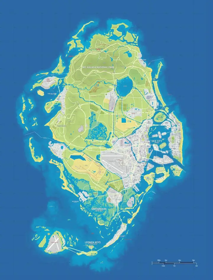
Positions are estimates from gtadb.org's community reconstruction. Its research includes official and unofficial material; a marker is not confirmation by Rockstar Games.
See the six main areas on the full map
Start at the statewide view to see the relationship between Vice City, the offshore islands and the inland towns. Choose an area below to reopen the map at a representative pin. When that pin is a visitor centre or a mountain, it gives you a place to start looking. The pin itself does not describe the limits of the surrounding region.
- Vice City is the dense urban reference point. Zoom in around the waterfront to separate neighbourhoods from nearby island and port markers.
- Leonida Keys uses Key Lento as a starting point for the island chain. At a closer zoom you can see where the community map draws road connections over water.
- Grassrivers opens the Visitor Center marker. Look at the surrounding waterways before planning a drive, since a straight line can cross open water.
- Port Gellhorn gives you a town-level reference for motels, transport and the nearby raceway.
- Ambrosia leads into the inland industrial area. Search Allied Crystal to move from the broad town label to the refinery area.
- Mount Kalaga National Park opens the named peak. Zoom back out from the pin to see how the surrounding high ground fits the wider community map.
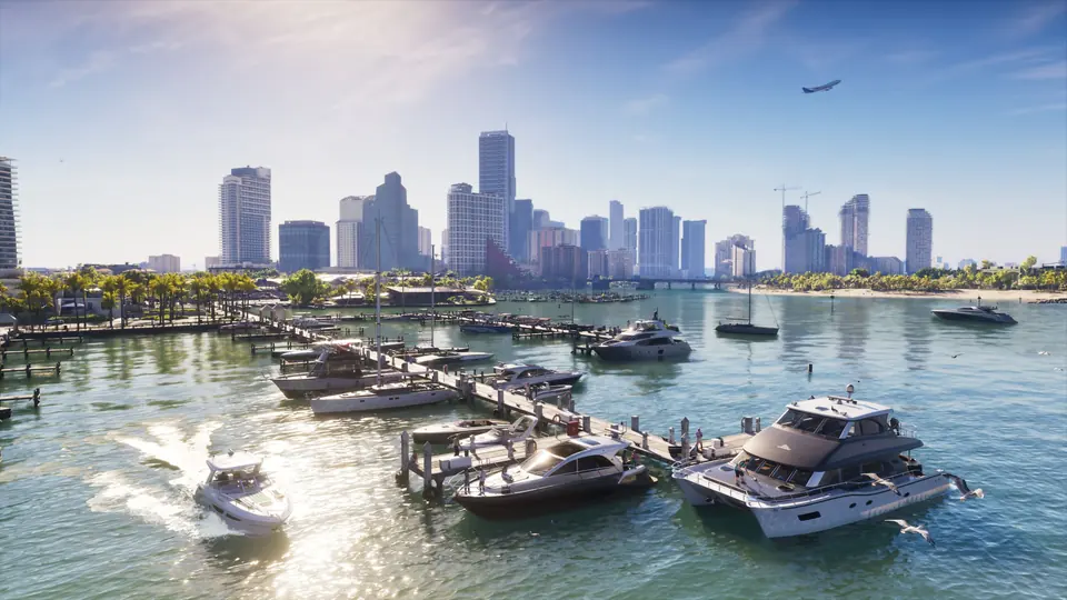
837 mapped records by category
The 38 English category pages below open the same base map with a single category selected. Choose Safehouses if you want shelter markers, Gas Stations for fuel stops, or Districts & Neighborhoods to orient yourself before opening a business card. Choose Landmarks & Nature when you know a bridge, peak or other feature but cannot identify the nearest district.
Shops
Vehicles & Transport
Food, Fun & Nightlife
Places & Areas
How to find a specific place on the full map
- Search for the name visible in your source. Try a distinctive word such as Tisha or Gellhorn before typing a broad label like Bridge. On a phone, open the filter panel first.
- Open the result and read its category, the region and the source note. When several entries share a generic name, use region and nearby markers to distinguish them.
- Use the category page or the location link to return to the same listing. If you track visits on this site, export a backup before clearing browser data or changing devices.
- When a candidate route crosses a bridge, island chain or wetland, check it in your game before relying on it. The map can show the community's current placement without proving a road is open or an interior is accessible.
GTA 6 full map compared with GTA 5
| Feature | GTA 6 | GTA 5 |
|---|---|---|
| Main city | Vice City. Start near the coast and distinguish the city from Vice Beach and the Keys. | Los Santos. The city is the urban anchor of the southern part of the map. |
| Beyond the city | Leonida includes a long island chain, southern wetlands, industrial towns and a northern wilderness. | Blaine County includes the Alamo Sea, desert settlements and Mount Chiliad. |
| Reading the map | Water crossings separate many destinations. A nearby mark may require a bridge or a different approach. | Los Santos and Blaine County share broad mainland highway connections. |
| What the point count covers | The number above counts named records in this site's community dataset. | Collectible totals depend on which GTA 5 activity, version and game mode you are looking at. |
Compare the kinds of places and the roads between them before looking for a size ratio. In both games a city-centre street grid and an open rural road can feel very different at the same zoom. See the GTA 6 Map Size guide for the area estimates and the definitions behind them.
What the full view covers today
All current site categories are available on the same map. The inventory includes region and district labels as well as individual buildings. Those are different kinds of records: a region pin can sit near several named stops without those stops counting as part of the region pin. Rockstar's named settings are useful reference points, but the positions and coverage of this inventory come from the community project. Use the GTA 6 Map Leaked comparison if you are checking a claim made about a circulating image or looking for Rockstar's printable edition.
Frequently asked questions
What does the GTA 6 full map cover?
837 named community records in 38 categories cover region labels, districts, businesses and landmarks on the GTA6Maps.wiki map.
Is this the official GTA 6 map?
837 records on this independent fan map come from gtadb.org and use the YANIS V17 reconstruction. The map shows community estimates.
Can I browse only one type of location?
1 category can be shown at a time by opening its map page or switching the other layers off. This site has 38 category views in English.
Where is Vice City on the full map?
1 Vice City marker opens the city area. Zoom in from there to see the coastal districts and individual locations.